
Disaster Response and GIS
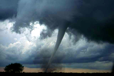
The web is buzzing with posts, tweets and updates of the devastation that occurred Monday afternoon in Oklahoma City. With almost a 20 mile trail of destruction, the tornado ravaged through neighborhoods and schools in the city of Moore, just minutes south of downtown OKC. At the time of this post, 24 fatalities have been declared, grimly followed by more than two hundred injuries. Even with dispatched FEMA aid, the clean-up, repair and recovery is estimated to cost millions of dollars.
We watch the news. We see the pictures and the videos taken of the waste and rubble left behind as the tornado carved its path and we wonder to ourselves, “Surely there must be some way to find solace in all of this grief.” And, as obscure as it may seem, there is always a silver lining. Its times like these that show who we are as a nation. We may not all be able to rush to Oklahoma to help in the relief efforts, but we never fail to pull together as one unstoppable force of support, whether in the form of donations or sympathy, in hopes that our resources, however remote they may be, can help lessen the burden of the families affected by tragedy.
At the GIS Center, we’re major advocates in introducing GIS technology and applications to as many aspects of daily life as possible. Thanks to the Google Response Team, GIS has found yet another way to promote disaster relief. They developed a web map that provides a spatial aspect to all the information released on the event. Whether you’re a victim or relative across the country trying to make sure your family is safe; the Crisis Map can help. Areas displaying severity of damage are available, as well as information on shelters and area closings. Storm reports and traffic information are simple clicks away. Most importantly, however, are the links to official state department social media (OKDOT and City of OKC for the most up-to-date information as well as a Safe and Well to make sure loved ones are out of harm’s way. Ways to support and donate, via Red Cross and the OKStrong movement are also available. It’s never easy to deal with such unfortunate tragedies, but advancing technology like GIS makes it so much quicker and easier to spread information that has the potential to save lives than ever before.
Find more information on the Google Response Team and their Crisis Map here.
Leave A Comment
You must be logged in to post a comment.